In Brief
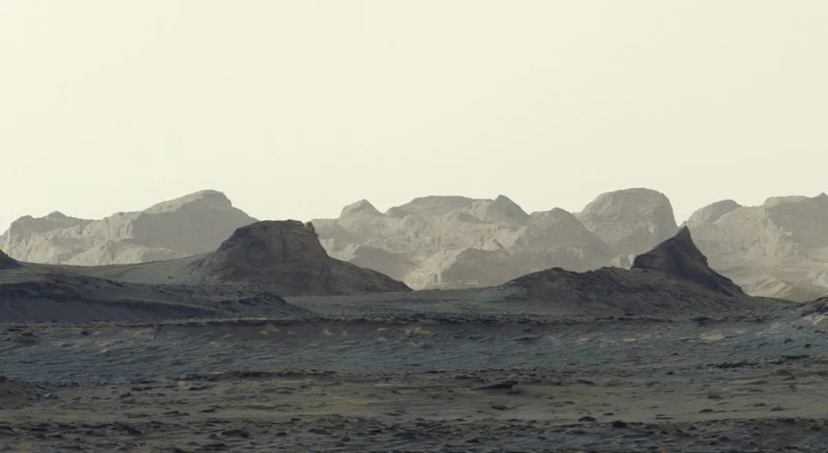
- NASA's Curiosity rover captured a landscape photograph approximately one hour after sunrise in Gale Crater on Mars.
- Scientists believe the illuminated craggy peaks were formed billions of years ago from wind-blown sediment, sand, or volcanic ash that hardened over time.
- The car-sized Curiosity rover has been exploring Mars since its landing in 2012, continuously analyzing the red planet's ancient geological history.
NASA’s Curiosity rover has captured a new image of dawn breaking across the Martian surface, showing early morning light illuminating ancient, jagged rock formations inside Gale Crater.
The photograph was snapped by the six-wheeled rover's Mastcam camera approximately an hour after sunrise on August 11, 2026—the 4,982nd Martian day, or sol, of the mission—and released by NASA on October 6, 2026.
The image highlights distant, elevated crags known as yardangs—ridges shaped over eons by atmospheric wind erosion. According to NASA planetary scientists, the rock layers forming these prominent peaks originated billions of years ago during a dynamic geological era on Mars.
“We think it once was wind-blown sediment, maybe sand or maybe even ash that blew into the crater from nearby volcanic activity,” said Ashwin Vasavada, Curiosity project scientist at NASA’s Jet Propulsion Laboratory in Pasadena, California.
After those ancient sediments accumulated and compressed into solid rock layers, centuries of wind action carved out the sharp, elevated features visible in the landscape today.
Curiosity landed near the Martian equator in Gale Crater in August 2012. Since 2014, the rover has been gradually ascending Mount Sharp, a five-kilometer-tall mountain rising from the crater floor, examining rock layers to assess whether Mars ever possessed environmental conditions capable of supporting microbial life.
The rover remains operational alongside NASA's Perseverance rover, which continues to explore Jezero Crater in the planet's northern hemisphere.